
Location
Life in the northern foothills of the Santa Catalinas
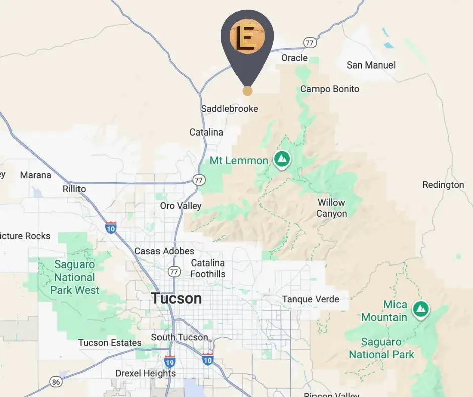
ELEMENT sits on the north face of the Santa Catalina Mountains in Pinal County, Arizona, about 30 miles north of Tucson and a thousand feet above it. Biosphere 2 is a mile up the road. The Arizona Trail, a certified Dark Sky Park, and the Coronado National Forest are all within a few miles. People have been coming to this air to heal since the 1880s.
At a glance
- 43.5 acres in a serene canyon on the north face of the Santa Catalina Mountains, in Pinal County, Arizona.
- Up to 20 residences on 1.25–1.5-acre home sites, across five phases.
- Master-planned and off-grid-capable, with organic gardens, a community center, and walking trails.
- 3,456 feet of elevation, roughly a thousand feet above the Tucson valley floor.
- Biosphere 2, the University of Arizona research campus, sits about a mile away.
- Free of overhead power lines and cell towers, a few miles from national forest and a certified Dark Sky Park.
- Satellite internet keeps the home office connected without a tower on the ridgeline.
Getting there
Close to everything, surrounded by nothing
Set well back from the noise of the city, but not off the map. The community reaches State Route 77 through SaddleBrooke, and from there Tucson and its airport are a straight run south. A 24-hour emergency room sits about half an hour away in Oro Valley, and the everyday shops of the Catalina corridor are closer still.
| Destination | What it is | Approx. |
|---|---|---|
| Bashas' supermarket, Catalina | The nearest full supermarket | ~9 mi · ~20 min |
| Oro Valley Hospital | Nearest 24-hour emergency room | ~15 mi · ~30 min |
| Catalina State Park | 5,493 acres at the foot of the range | ~15 mi · ~30 min |
| Biosphere 2 | University of Arizona research campus | ~17 mi · ~35 min |
| Oracle | The nearest town | ~20 mi · ~35 min |
| Downtown Tucson | Dining, arts, and the university | ~28 mi · ~50 min |
| Tucson International Airport (TUS) | Commercial flights | ~37 mi · ~65 min |
| Phoenix Sky Harbor (PHX) | International hub | ~108 mi · ~2¼ hrs |
Approximate driving distances by road from the community, via State Route 77. Straight-line distances are shorter — Biosphere 2, for example, is about a mile away as the crow flies, but the drive routes out to the highway and back. Times are estimates and will be confirmed once site access is complete.

Why here
In 1882, Acadia Ranch opened in Oracle as a sanatorium, and a leading medical journal made this high-desert air internationally famous as a cure for tuberculosis and other lung afflictions. People traveled here from around the world believing the air itself would restore them to health. A century and a half later, ELEMENT is being built on the same ground, for the same reason.
Points of interest
Around ELEMENT
The land around the community is not a subdivision. It is a state park, a national forest, a national scenic trail, and one of the most famous science experiments ever built.
| Place | What it is | Distance |
|---|---|---|
| Biosphere 2 | The largest closed ecological system ever built, owned and operated by the University of Arizona. Three acres of sealed rainforest, ocean, savanna, and desert under glass, open to the public. It sits about a mile north of the community as the crow flies, though the drive routes out to the highway and back. | ~1 mile |
| Oracle State Park | A certified Silver-tier International Dark Sky Park, designated in 2014 by the International Dark-Sky Association and the first Arizona State Park to earn it. Nearly 4,000 acres of oak, grassland, and granite, with more than 15 miles of trail and the 1930s Kannally Ranch House on the National Register of Historic Places. Day use only, which is part of why the sky stays so dark. | ~6 miles east |
| The Arizona National Scenic Trail | The Mexico-to-Utah trail runs through this country a few miles east, threading through Oracle State Park. Oracle is an officially recognized Arizona Trail Gateway Community, and Passage 13 is named for the town. | ~6 miles east |
| Coronado National Forest | The Santa Catalina Ranger District covers roughly 265,000 acres of the Catalinas, part of the 1.7-million-acre "Sky Islands" forest, rising to the south and east. | A few miles |
| Mount Lemmon & the SkyCenter | The 9,157-foot summit of the Catalinas, home to the southernmost ski area in the continental United States and to the University of Arizona's Mt. Lemmon SkyCenter, whose 32-inch Schulman Telescope is the largest dedicated publicly accessible telescope in the Southwest. It stands above the community, though reaching it means the unpaved Control Road or the paved Catalina Highway around by Tucson. | ~9 miles |
| Peppersauce Canyon | A shaded creek canyon of oaks and sycamores at the foot of Mount Lemmon, with a Coronado National Forest campground. | ~9 miles |
| Catalina State Park | 5,493 acres of saguaro forest, canyons, and birding at the base of the range, with trails climbing into the national forest. | ~10 miles |
Straight-line distances from the community.
Dark skies
A sky the region has protected for fifty years
Southern Arizona is the astronomy capital of the United States, and it has defended its night sky longer than almost anywhere on earth: Tucson wrote the world's first comprehensive outdoor lighting code in 1973 to protect its observatories, and DarkSky International is headquartered there to this day. A few miles east, Oracle State Park is a certified International Dark Sky Park. The University of Arizona's SkyCenter observatory sits on the mountain above. Here, the Milky Way is not a rumor.
Elevation
A thousand feet above the valley floor
Elevation is the quiet luxury of this location. The community sits at 3,456 feet, roughly a thousand feet above Tucson, in the high desert of oak, grassland, and granite rather than on the bare valley floor. Above it, the Santa Catalinas keep climbing, all the way to a ski run.
| Elevation | |
|---|---|
| ELEMENT | 3,456 ft |
| Tucson | 2,388 ft |
| Mount Lemmon summit | 9,157 ft |
Site elevation from the USGS 3D Elevation Program at 32.56118° N, 110.85156° W.
Everyday life
Everyday life
The Catalina corridor, a few minutes south on State Route 77, carries the everyday errands: a full supermarket, a pharmacy, urgent care, and a row of long-standing local restaurants. Oro Valley, a little further on, adds the rest.
Groceries
| Where | What | Distance |
|---|---|---|
| Bashas' Oracle & Golder Ranch | Full supermarket in Catalina, with an organic department and a pharmacy | ~9 mi · ~20 min |
| Rancheros Market | Neighborhood market on the corridor | ~8 mi · ~19 min |
| Safeway, Fry’s, Walmart & Target | Full retail in Oro Valley | ~14–16 mi · ~30 min |
| Trader Joe’s, Whole Foods, Sprouts & Natural Grocers | The premium and natural-foods cluster, all within about a mile of one another on N Oracle Road | ~19–21 mi · ~35 min |
| Heirloom Farmers Market, Oro Valley | Saturdays year-round at Steam Pump Ranch | ~15 mi · ~30 min |
Dining
| Where | What | Distance |
|---|---|---|
| Mi Tierra | Mexican, Catalina | ~8 mi · ~18 min |
| Claire's Cafe & Art Gallery | Cafe and gallery | ~8 mi · ~18 min |
| Carlota's | Authentic Mexican | ~8 mi · ~18 min |
| It's Greek to Me | Greek | ~8 mi · ~19 min |
| Sunnyside Up | Breakfast, Catalina | ~8 mi · ~19 min |
| Chuys Mesquite Broiler | Mesquite-grilled | ~9 mi · ~20 min |
| Harvest Oro Valley | Farm-to-table | ~14 mi · ~28 min |
| The Views Restaurant | Dining over the golf course, Oro Valley | ~14 mi · ~28 min |
Long-standing local places in the Catalina corridor, nearest first. Chain and quick-service options sit alongside them along North Oracle Road.
Staying connected
The quiet has a technical cost, and the community answers it deliberately. With no cell towers on the ridgeline, homes are built to be Starlink-ready, so the office, the calls, and the work get a fast, low-latency connection from the sky rather than from a tower. Inside, every residence is wired with hardwired ethernet and low-EMF electrical design — the signal arrives by satellite and travels the house by cable.
Education
Schools
The community lies within the Oracle Elementary School District, whose PreK–8 campus, Mountain Vista School, is the nearest school of any kind. No high-school district covers this land — Oracle Elementary is a non-high-school district — so high-school students attend out of district, most commonly at Canyon del Oro or Ironwood Ridge in Oro Valley. Families should confirm current enrollment and transport with the districts directly. Private and charter options, including Pusch Ridge Christian Academy, Immaculate Heart, and BASIS, are in the Oro Valley and Tucson corridor.
In the community
Inside ELEMENT
The community is planned as one landscape rather than a grid of lots: five phases across five parcels, each subdivided into three to five home sites, woven together with shared land that stays open.
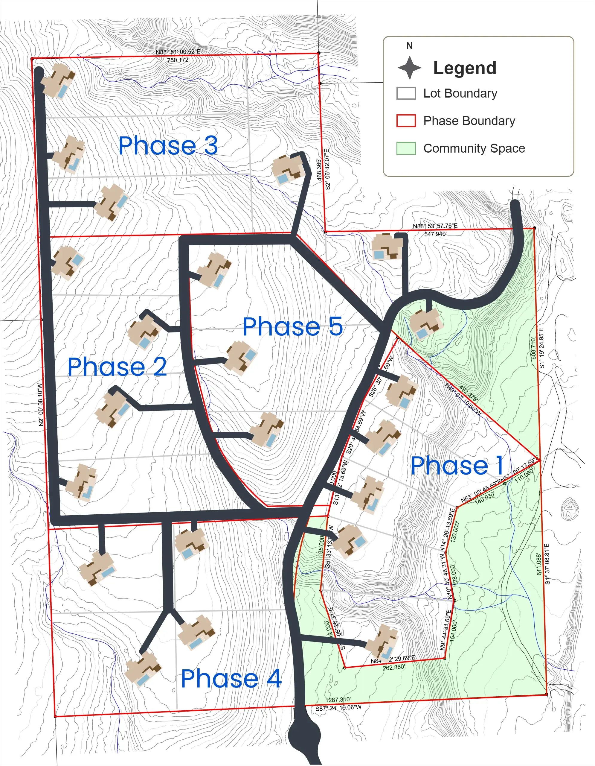
- 43.5 acres, master-planned across five phases
- Up to 20 residences on 1.25–1.5-acre home sites
- Organic gardens
- A community center
- Walking trails through the property
- Natural desert landscaping, kept intact
- Off-grid-capable infrastructure
- No overhead power lines and no cell towers
The homes
What gets built here
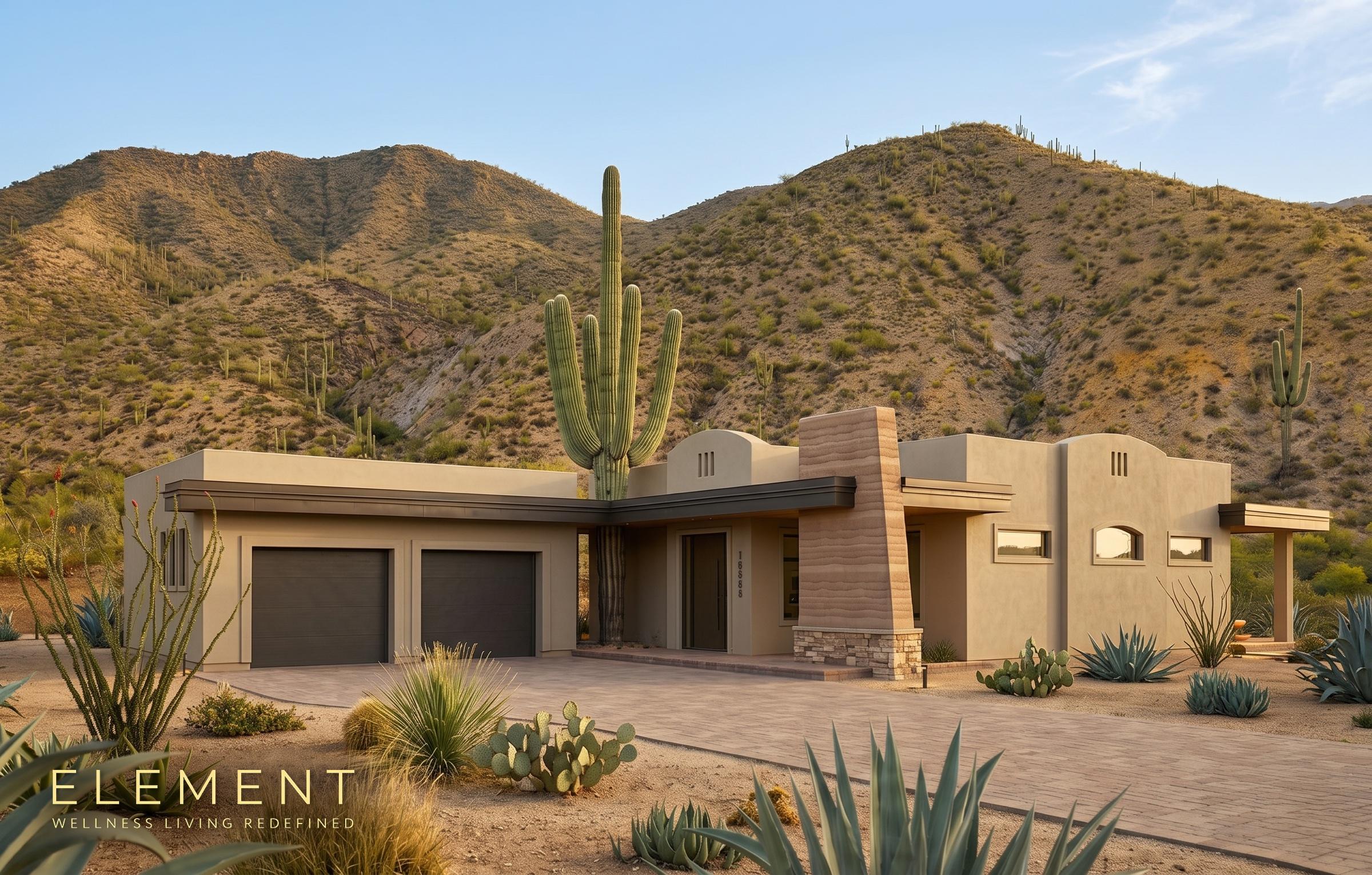
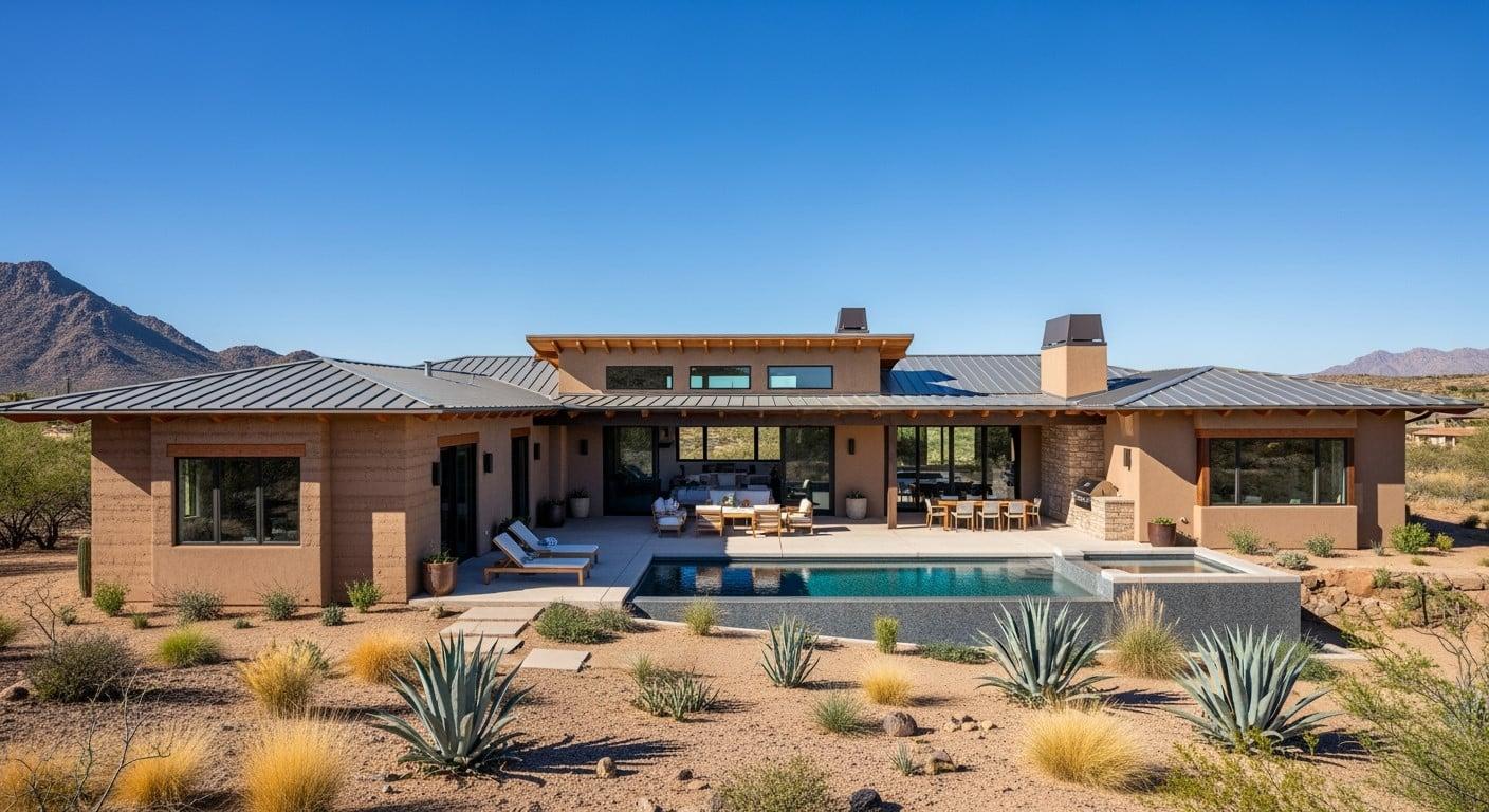
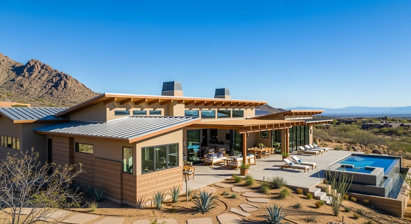
Three model residences, each designed to the SENERGY360 Healthy Design Specifications and sited on 1.25 to 1.5 acres.
The Land
43.5 acres at the foot of the Catalinas
Not renderings: this is the land itself, photographed on site. High-desert washes, saguaro and ocotillo, and the Santa Catalina Mountains standing over every home site.
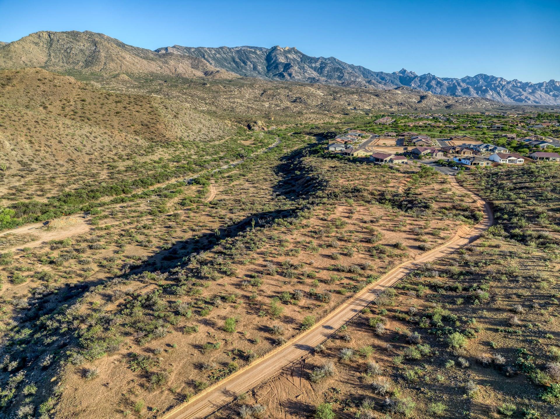
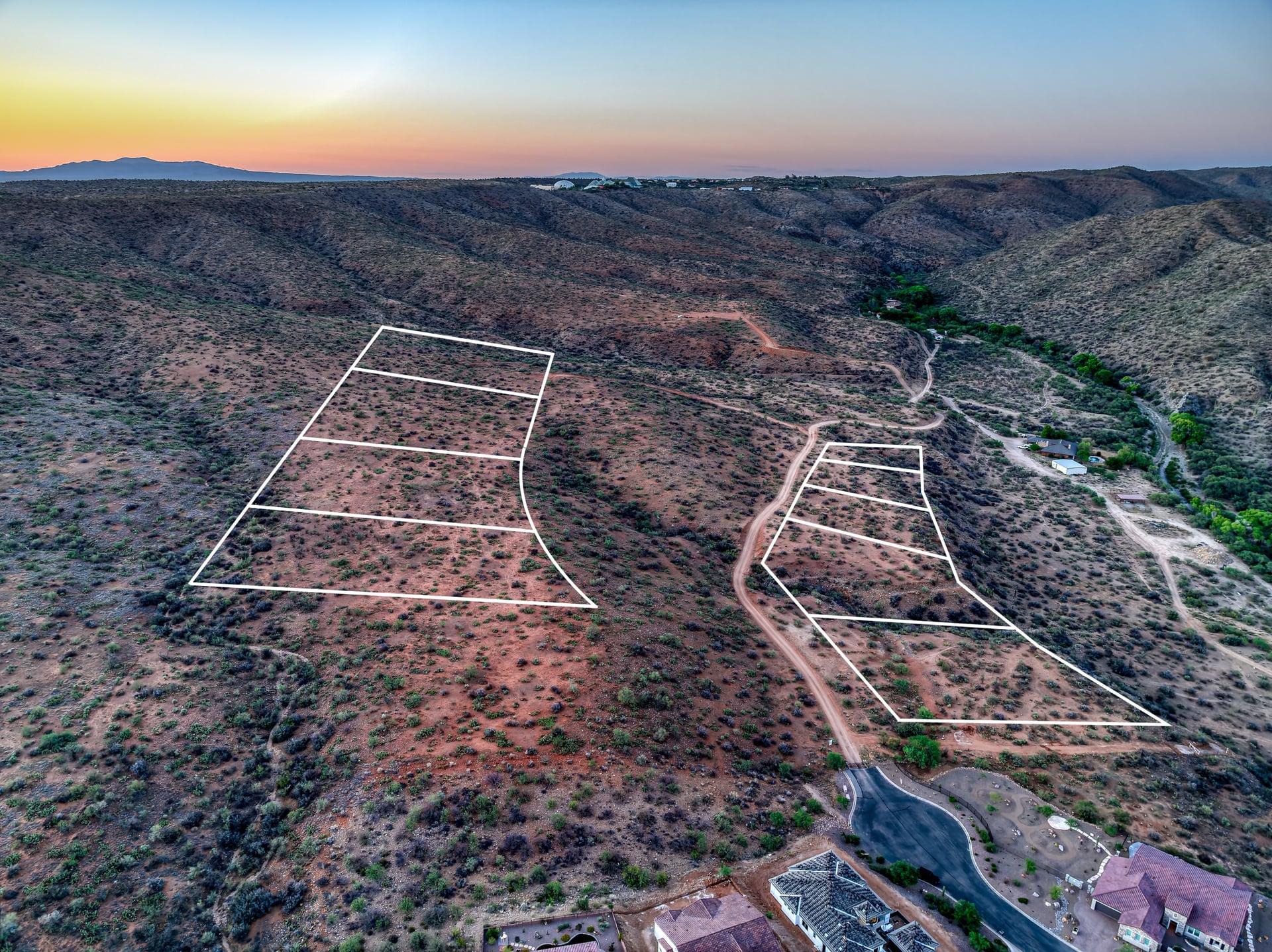
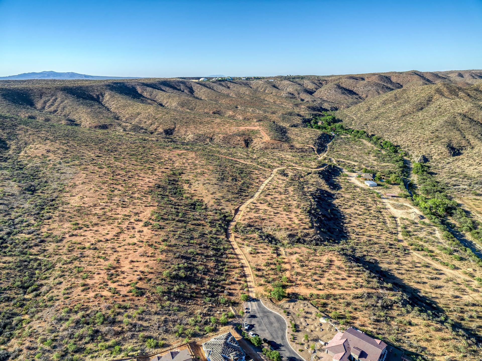
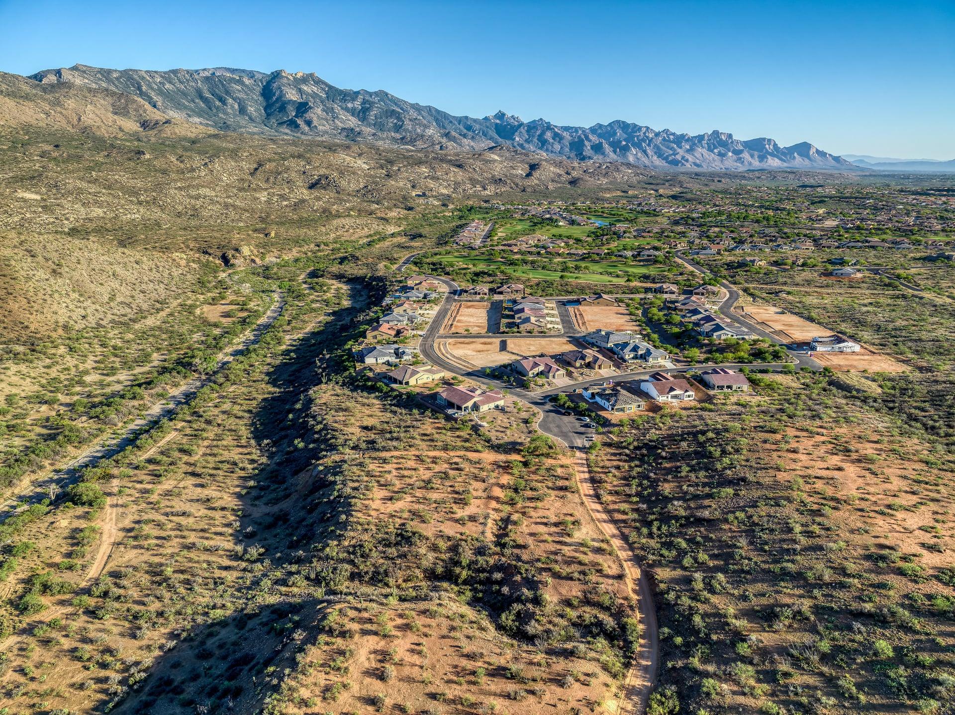
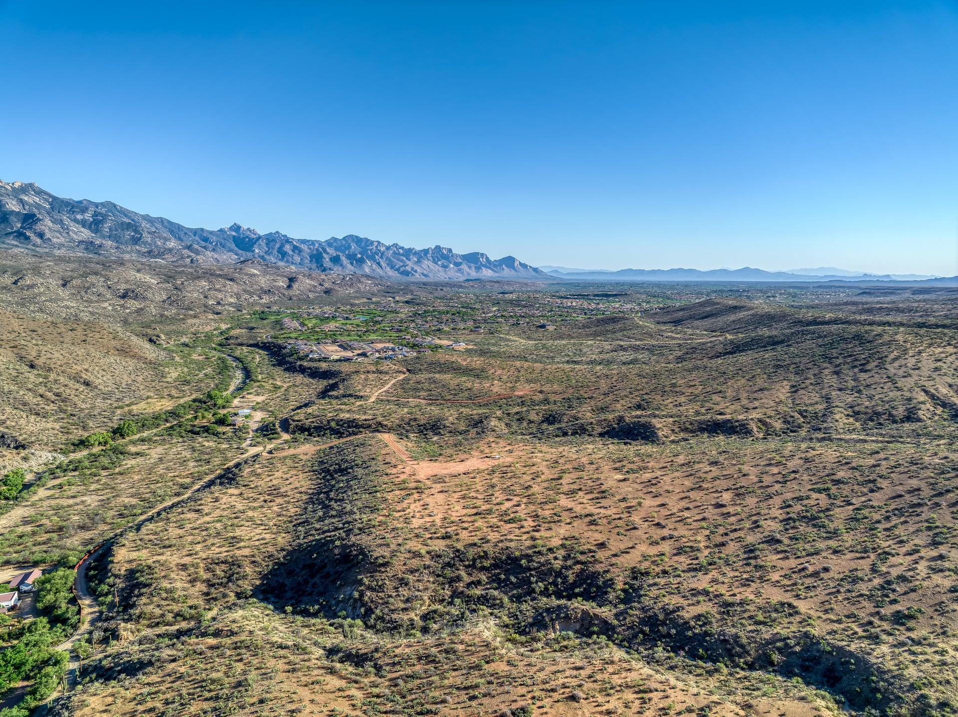
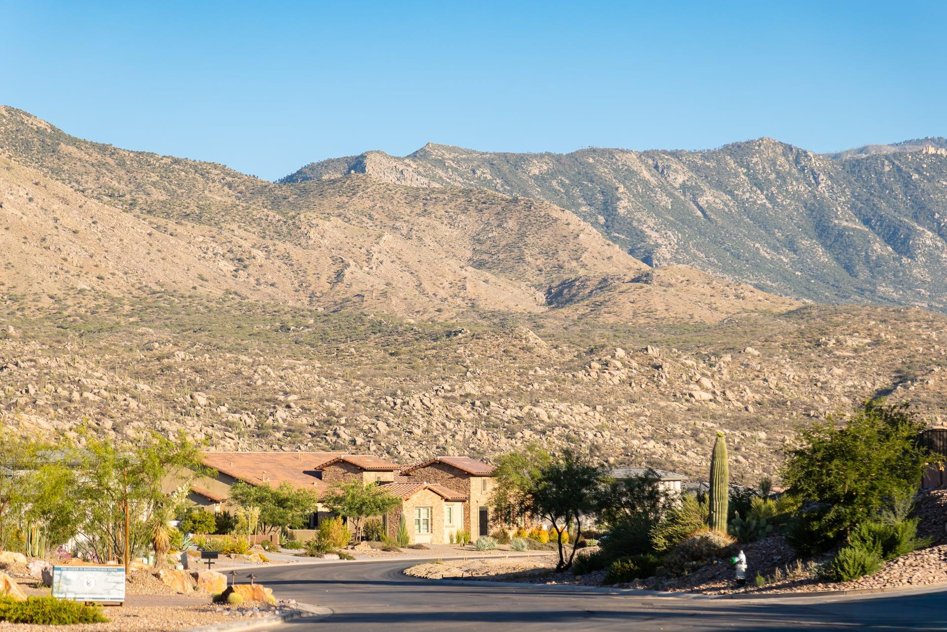
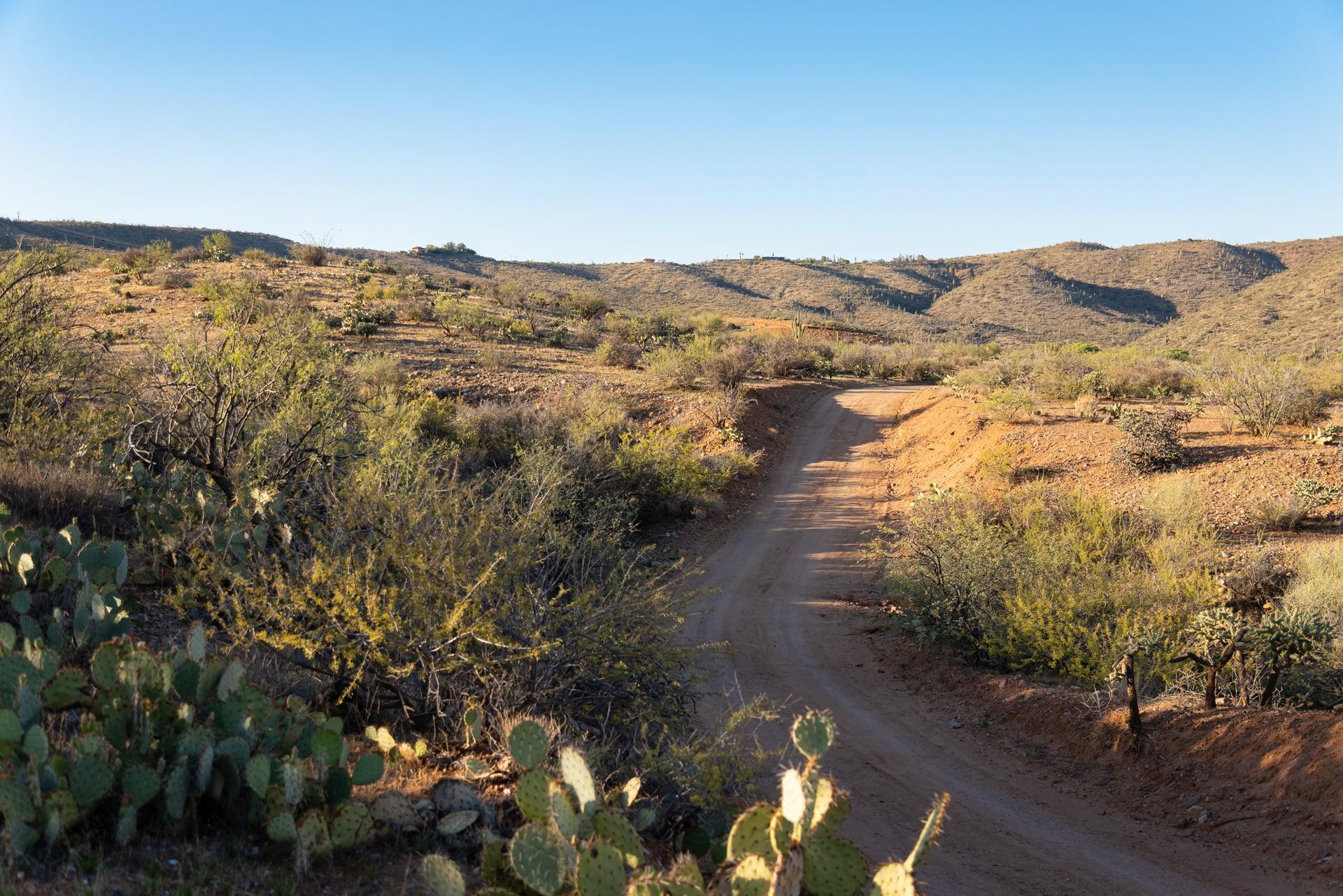
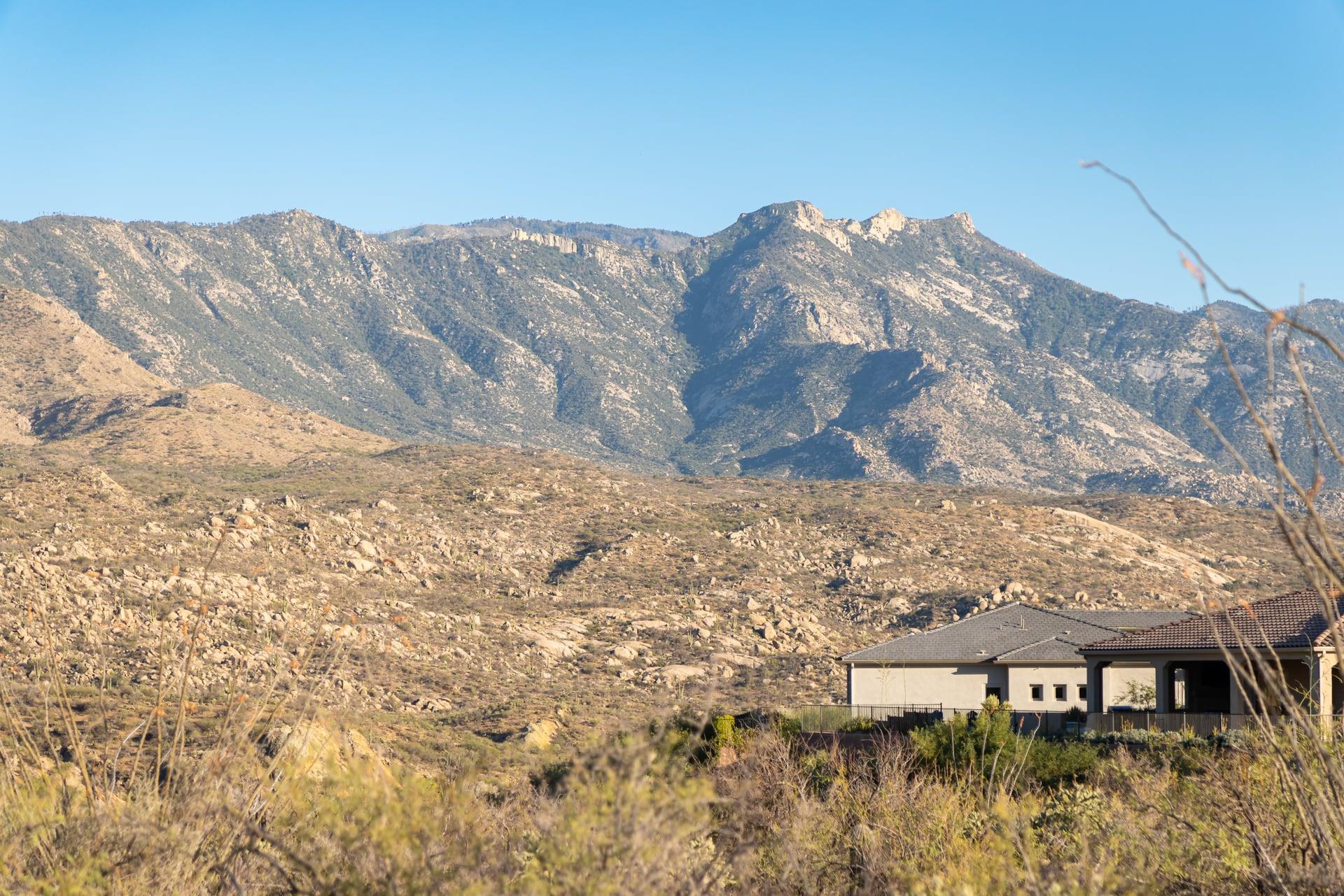
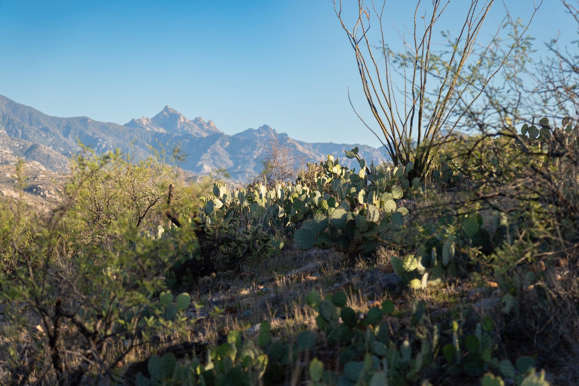
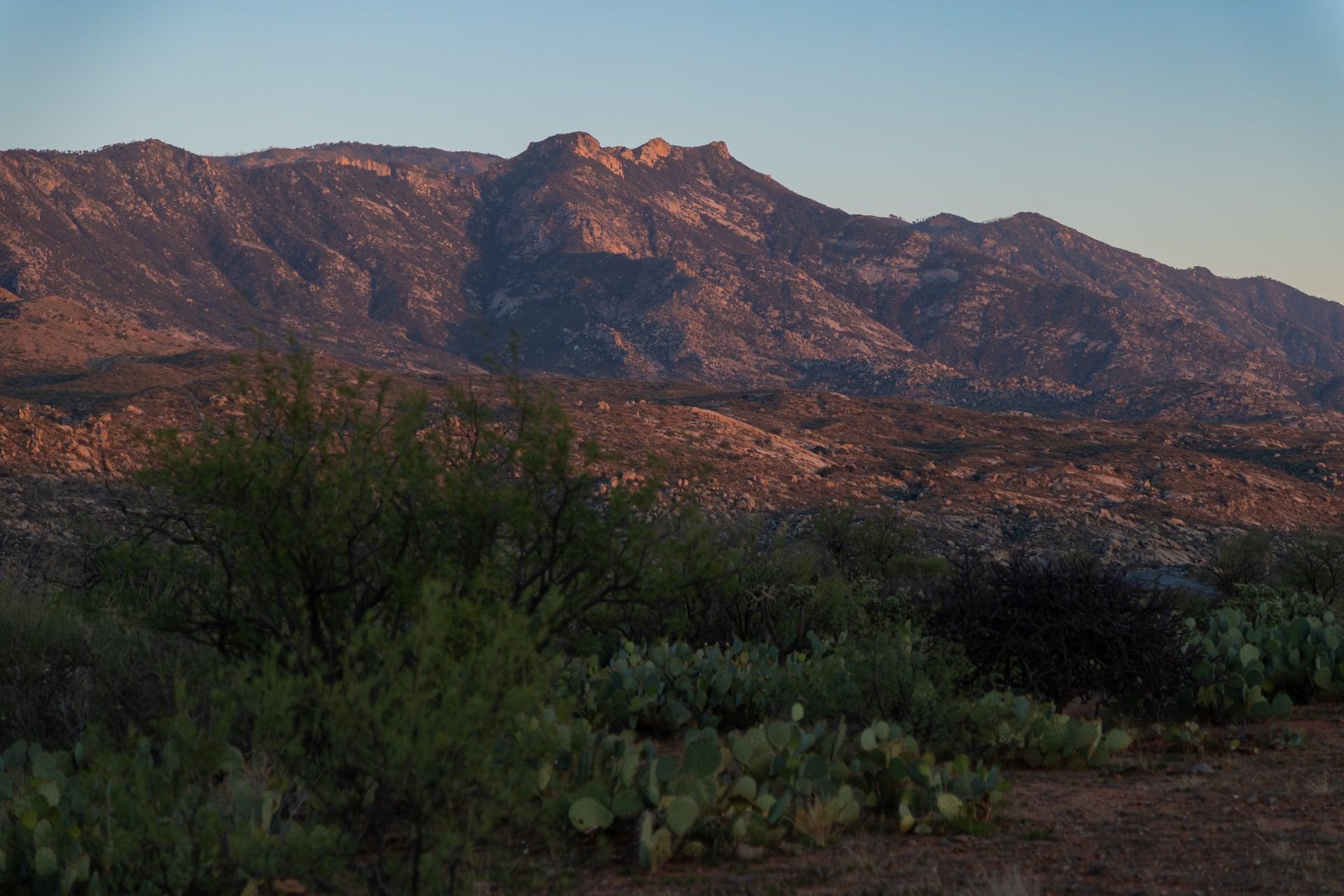
Photography: Shadow Point Media
Come see it
Walk the land
Reach out to arrange a visit to the site, or to talk through home sites and availability.